
Arnis Turns Any Real Location Into a Playable Minecraft World Instantly
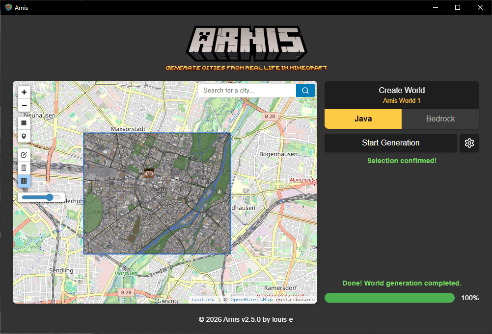
Arnis is a free, open-source Rust tool that turns any OpenStreetMap location into a playable Minecraft world, complete with real terrain elevation, roads, and buildings
Takeaways
- Arnis is a free, open-source Rust tool that converts any real-world location into a playable Minecraft world using OpenStreetMap data.
- It uses a multi-step pipeline: fetch OSM vector data, preprocess elevation from AWS Terrain Tiles, apply smoothing, then write Minecraft Anvil format files.
- Supports Java Edition (1.17+) and Bedrock Edition on Windows, macOS, and Linux; a browser-based version called MapSmith requires no install.
- Quality depends entirely on OpenStreetMap coverage -- dense cities generate detailed worlds, rural areas may have gaps.
- Real use cases include education (Floodcraft flood-preparedness research), urban planning visualization, and custom Minecraft server maps.
- The project has 17k+ GitHub stars, 1.4k forks, and has served nearly 300,000 users with zero data retrieval costs via AWS Open Data sponsorship.
Arnis does something that sounds deceptively simple: pick any spot on Earth, draw a rectangle around it, and get a playable Minecraft world back. Roads, buildings, rivers, parks, and real terrain elevation -- all generated automatically, no AI, no manual block-placing. The project has quietly grown to over 17,000 GitHub stars and 1,400 forks, with coverage from AWS, Tom's Hardware, and academic researchers using it for K-12 education.
The pipeline under the hood
Arnis uses OpenStreetMap (OSM) for building footprints, roads, land use, and other map features, fetched via the Overpass API. That raw vector data tells the tool where every building, road, and park boundary sits in the real world. Arnis does not use AI or machine learning -- it reads real geographic data from OpenStreetMap and elevation datasets, then deterministically converts that data into Minecraft blocks using rule-based algorithms.
Elevation is handled separately. In 2025, Arnis migrated from a commercial elevation data provider to Terrain Tiles, hosted on Amazon S3. Through the Open Data Sponsorship Program, AWS covers the cost of data distribution for publicly available datasets like Terrain Tiles, enabling open-source projects like Arnis to access high-quality geospatial data at scale with no cost. More recently, regional high-resolution providers (USGS 3DEP, IGN France, IGN Spain, Japan GSI) now complement AWS Terrain Tiles for sharper coverage across North America, Europe, and Asia.
The processing chain is multi-step and carefully ordered:
- These steps create a height grid in meters that corresponds to Minecraft's block scale. Arnis applies a smoothing algorithm to remove artifacts before performing missing value correction to patch gaps. Data validation checks prevent stray values from becoming vertical spikes or pits.
- Adaptive vertical scaling maintains mountainous regions within Minecraft's build limits while preserving local relief in flatter areas.